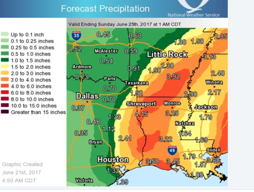
...A Flash Flood Watch has been posted for the southern half of
Northeast Texas and all of Northern Louisiana beginning at 7 pm
Wednesday and continuing through 7 am Friday.
The National Weather Service in Shreveport has issued

a Flash Flood Watch for portions of Louisiana and Texas, including the following areas, in Louisiana, Bienville, Bossier, Caddo, Caldwell, Claiborne, De Soto, Grant, Jackson, La Salle, Lincoln, Natchitoches, Ouachita, Red River, Sabine, Union, Webster, and Winn.
In Texas, Angelina, Cherokee, Gregg, Harrison, Marion, Nacogdoches, Panola, Rusk, Sabine, San Augustine, Shelby, Smith, Upshur, and Wood.
* From Wednesday evening through Friday morning
* Tropical Storm Cindy will move inland across the Southeast Texas or Southwest Louisiana Gulf Coast sometime early Thursday Morning. As the remnants of Cindy move generally northward towards Northeast Texas or Northwest Louisiana, excessive, flood producing rainfall will be possible along and to the east of its track. Widespread 4-8 inch rainfall amounts will be possible with isolated higher totals across the Watch area beginning Wednesday Night and continuing through early Friday Morning.
* The flooding of roads, low lying areas, and areas with poor drainage will be possible. If encountering flooded roadways, remember to turn around, don`t drown.
PRECAUTIONARY/PREPAREDNESS ACTIONS...
A Flash Flood Watch means that conditions may develop that lead to flash flooding. Flash flooding is a very dangerous situation.
You should monitor later forecasts and be prepared to take action should Flash Flood Warnings be issued.


